
| sorghum (type unspecified) | USDA PLANTS Symbol: SOBI2 U.S. Nativity: Exotic Habit: Grass or Grasslike |
| Sorghum bicolor (L.) Moench |
Jump to: Images | Distribution Maps | Sources
|
Taxonomic Rank: Liliopsida: Cyperales: Poaceae |
| Synonym(s): black amber, broom-corn, broomcorn, chicken corn, shatter cane, shattercane, wild cane |
| Native Range: probably Africa () |
| Selected Images from Invasive.org | View All Images at Invasive.org |
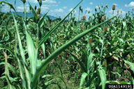 Field; with purple witchweed USDA APHIS PPQ - Oxford, North Carolina , USDA APHIS PPQ, Bugwood.org Additional Resolutions & Image Usage |
 Damage; caused by purple witchweed USDA APHIS PPQ - Oxford, North Carolina , USDA APHIS PPQ, Bugwood.org Additional Resolutions & Image Usage |
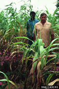
 Plant(s); Plants of sugar sorghum in the field. Howard F. Schwartz, Colorado State University, Bugwood.org Additional Resolutions & Image Usage |
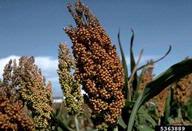
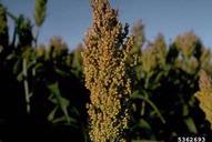 Plant(s); The grain head of a sorghum plant growing on a field at Rocky Ford in Colorado. Howard F. Schwartz, Colorado State University, Bugwood.org Additional Resolutions & Image Usage |
 Field; The heads of grain sorghum plants growing on a field at Rocky Ford in Colorado. Howard F. Schwartz, Colorado State University, Bugwood.org Additional Resolutions & Image Usage |
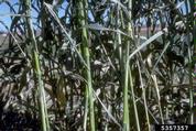
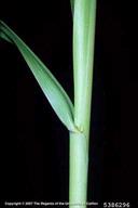 Stem(s); collar and sheath. Joseph M. DiTomaso, University of California - Davis, Bugwood.org Additional Resolutions & Image Usage |
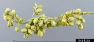
 Inflorescence(s); Fruiting inflorescences. Lyndon Photography, , Bugwood.org Additional Resolutions & Image Usage |
 Inflorescence(s); Fruiting inflorescences, dyed green, close-up. Christina Southwick, USDA APHIS PPQ CPHST, Bugwood.org Additional Resolutions & Image Usage |
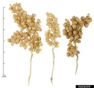
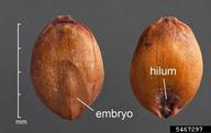 Fruit(s); Caryopses of shattercane (a form of ssp. bicolor) in dorsal (left) and ventral (right) views. D. Walters and C. Southwick, USDA, Bugwood.org Additional Resolutions & Image Usage |
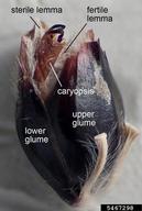 Spikelet(s); Close-up of a fertile spikelet of an uncultivated strain. D. Walters and C. Southwick, USDA, Bugwood.org Additional Resolutions & Image Usage |
| EDDMapS Distribution: This map is incomplete and is based only on current site and county level reports made by experts and records obtained from USDA Plants Database. For more information, visit www.eddmaps.org |
State List This map identifies those states that list this species on their invasive species list or law. 
|
| U.S. National Parks where reported invasive: |
| Lake Mead National Park (Nevada) |
| Invasive Listing Sources: |
| Jil M. Swearingen, Survey of invasive plants occurring on National Park Service lands, 2000-2007 |
| WeedUS - Database of Plants Invading Natural Areas in the United States |


